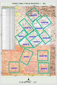
THAR COALFIELD
The Thar coalfield with a resource potential of 175 billion tonnes of coal covers an area of over 9,000 sq km in the Thar Desert in Thar Parkar district, in southeastern part of Sindh. The investigated area is covered by stable sand dunes and there are no rock exposures. To establish the coal resources in six selected blocks a total of 237 holes were drilled. The coal resources of the area within clastic sediments ofthe Bara Formation of Paleocene age. The measured reserves are over 2,357 million tonnes, indicated millions tonnes and inferred 1,362 million tonnes. The number of coal seams varies from hole to hole and a maximum of 20 seams have been logged in some of the drill holes. The thickness of coal seams ranges between 0.21 to 22.81 meters. The cumulative coal thickness varies and attains a maximum of 36 meters in one of the drill holes. Clay stone and loose sand beds form the roof as well as the floor-rock of coal seams. The overburden consists of three kinds of material; dune sand, alluvium and sedimentary rocks. The thickness of the overburden varies from 114 to over 203 meters. The sand dunes above the average ground level in the area will also add another 30 meters of thickness to the overburden. Chemical analyses of coal samples from the drill holes show that the weighted average of as received values of the Ash content ranges between 5.14 and 6.56 %, Volatile matter 26.50 and 33.04 %, Moisture 43.24 and 49.01 %, Sulphur 0.92 %, 1.34 % and 1.3% and Heating Values range between As Received 5,780 and 6,398 Btu/lb, Dry10,723 and 11,353 Btu/Lb MMM Free 6,101 and 6,841 Btu/lb, DAF 11605 and 12,613. The Volatile Matter Dry Ash Free (DAF) basis varies between 57.72 and 60 % the rank of coal is Lignite B to Lignite A. |
Coalfield Image:Technical Data:
|


